The UN Refugee Agency just released these two satellite images of 30 kilometer stretch of road west of Mogadishu known as the Afgooye corridor.
The first was taken October 2007:

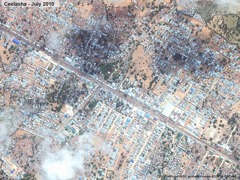
And this was taken July 2010:
 As you can see, a veritable city has sprung up over the past two and a half years. UNHCR estimates that 410,000 people, most of whom have been forcibly displaced because of fighting in Mogadishu, now live along this stretch of road.
From UNHCR:
Overall it appears that structures in Afgooye are becoming more permanent as hopes fade for a safe return to the capital any time soon. Over the past four weeks alone, almost 12,000 people have fled to the Afgooye corridor, which has become the third largest urban area in Somalia after Mogadishu and Hargeisa in Somaliland.
Living conditions in the Afgooye corridor are extremely difficult. People struggle for food and other basic necessities as the precarious security situation is preventing humanitarian agencies from accessing people in need.
Some assistance is getting there through UNHCR’s local partners, but the amounts are miniscule in comparison with the needs. Many people take risks and walk to Mogadishu and back every day in search of a daily living. Basic services such as health and education are scarce and rudimentary.
For comparison’s sake 410,000 is larger than the population of Oakland, California.